Login Register
Airborne Flight Planning is a general purpose web-based flight planning tool for NASA airborne research instruments. AirFliP was developed by the UAVSAR flight planning team.
Projects supported: AVIRIS & HyTES (Future: AIRSAR-NG & AirSWOT)
How do you create a flight plan?
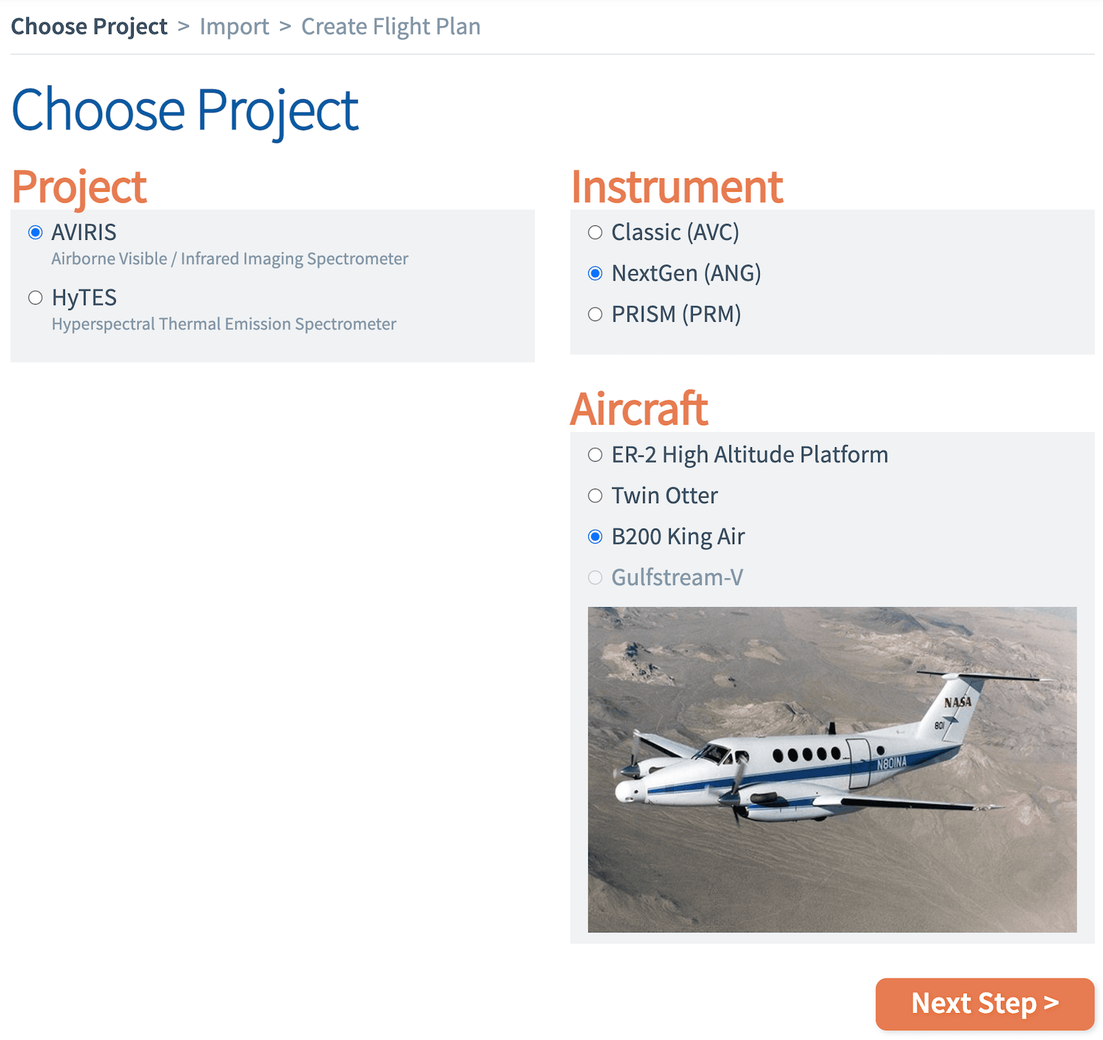
Step 1: Choose a project
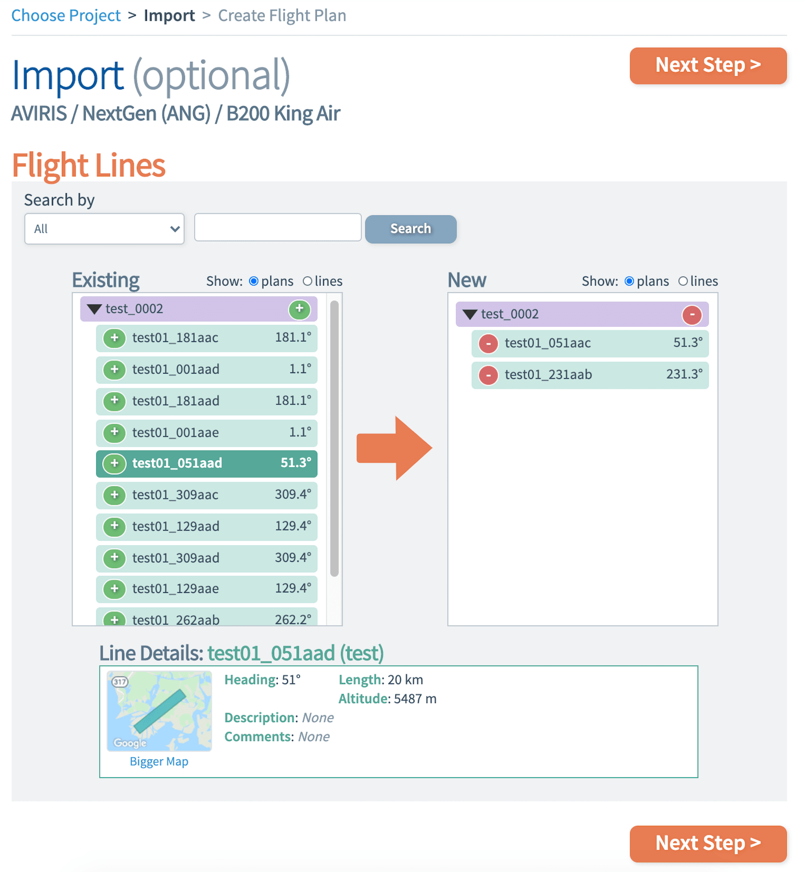
Step 2: Import lines
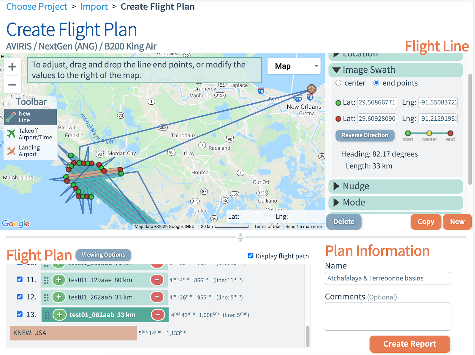
Step 3: Draw flight lines & choose airports
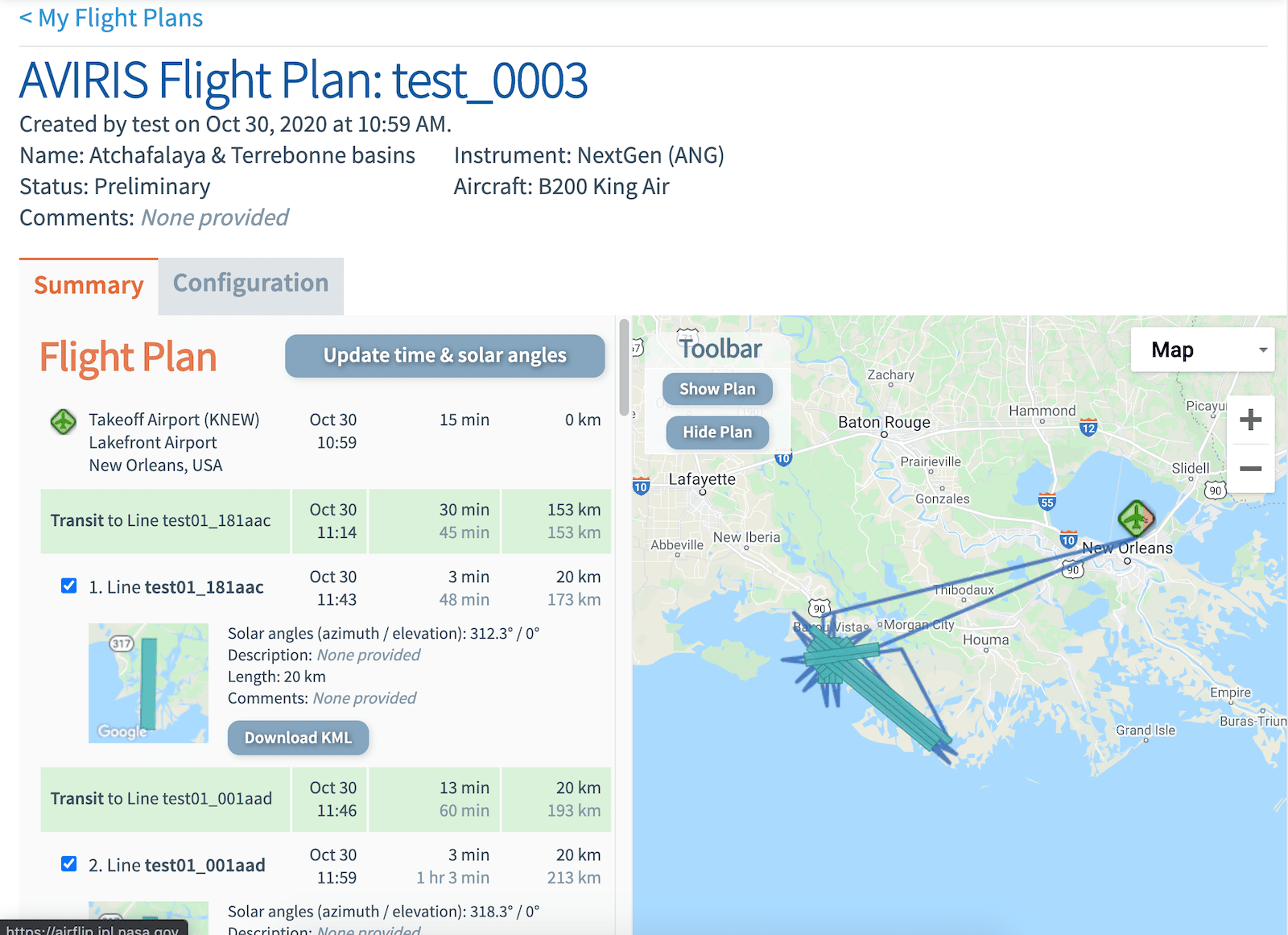
Step 4: Generate a flight plan report
Why AirFliP?
Anyone can make a flight plan
Save your plans & reuse them
Draw lines in Google Maps
Generate time & solar angle estimates
Create a shareable report
Generate operational plans for flight